
HONOR AWARD
Represents outstanding accomplishment in the profession of landscape architecture.

Three Creeks Confluence
“This project does indeed present a very high standard and should be a model for other cities dealing with blighted sites. The quality of work is excellent, and we really appreciate the thought process that went into every aspect of the design. This project design is successful due to the implementation of green infrastructure, multimodal transportation, habitat restoration, improving the water quality, and encouraging visitors to engage with this neighborhood. What a great improvement and asset to the community!”
PROJECT STATEMENT
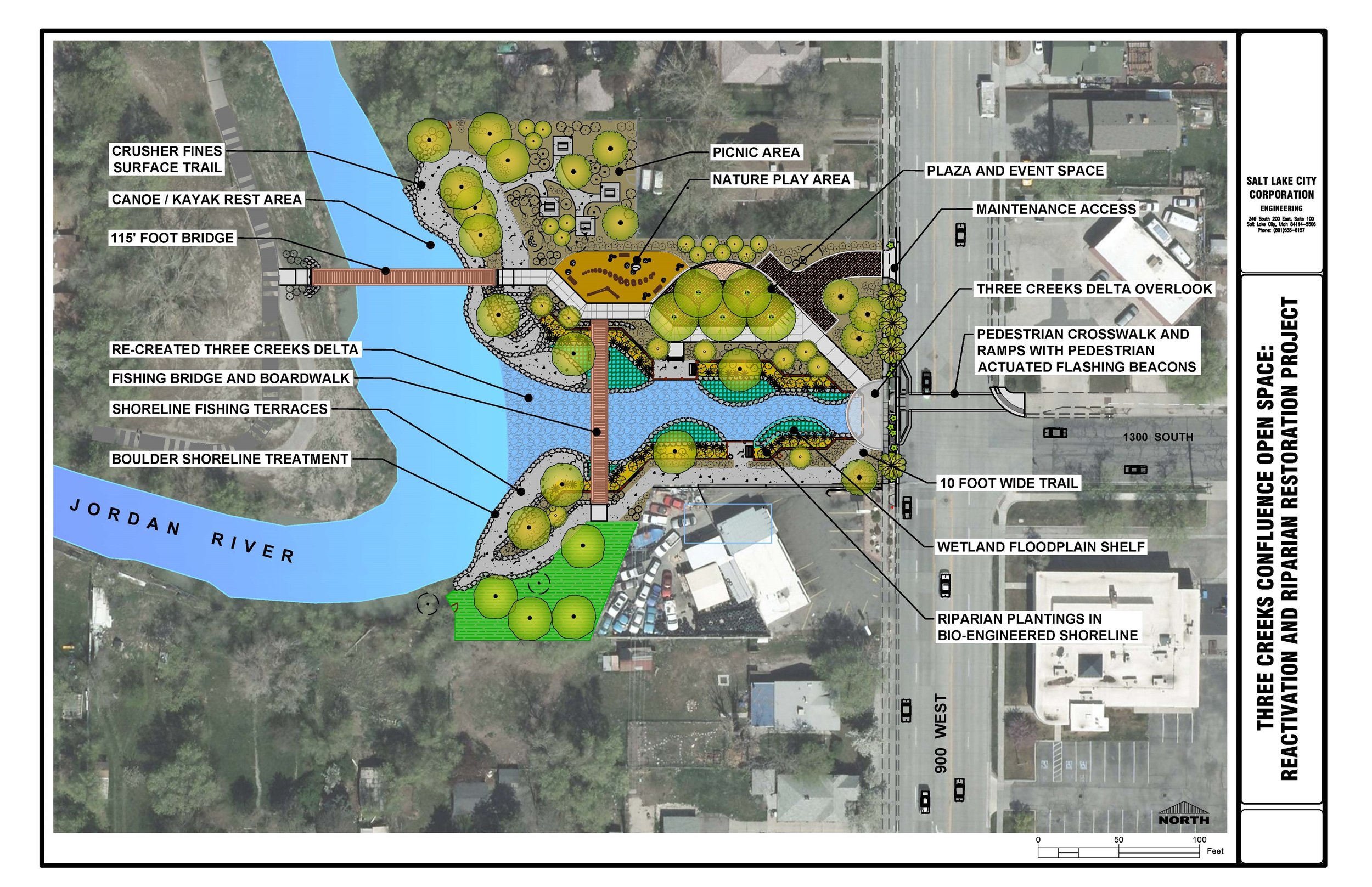
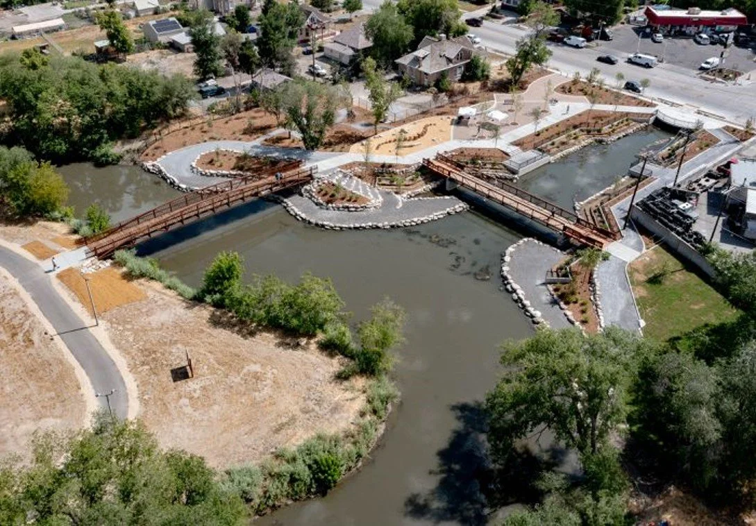
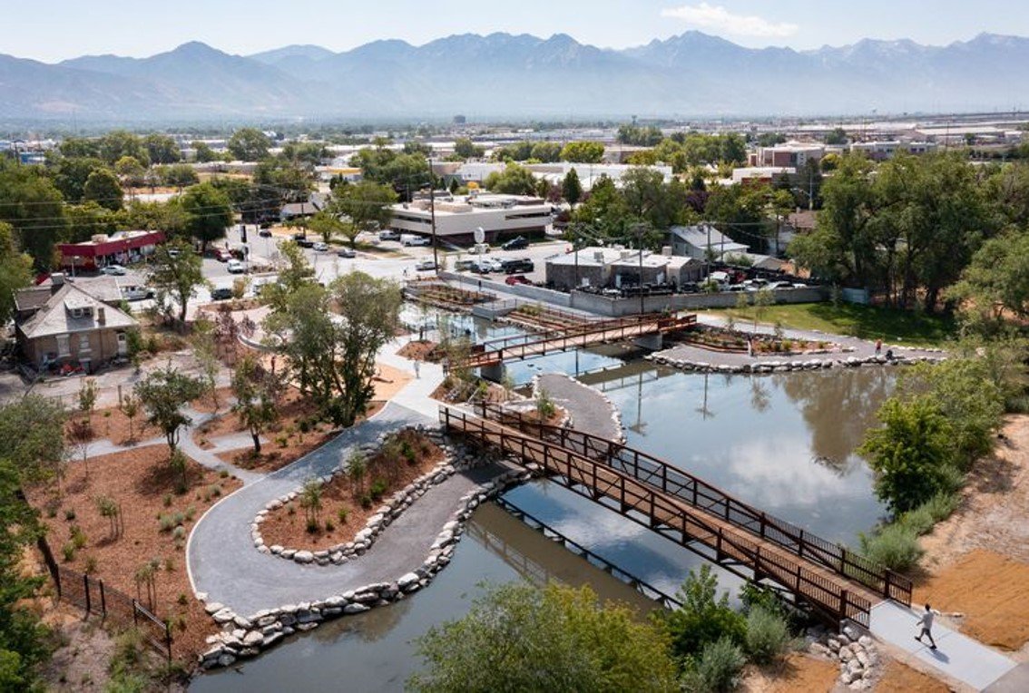
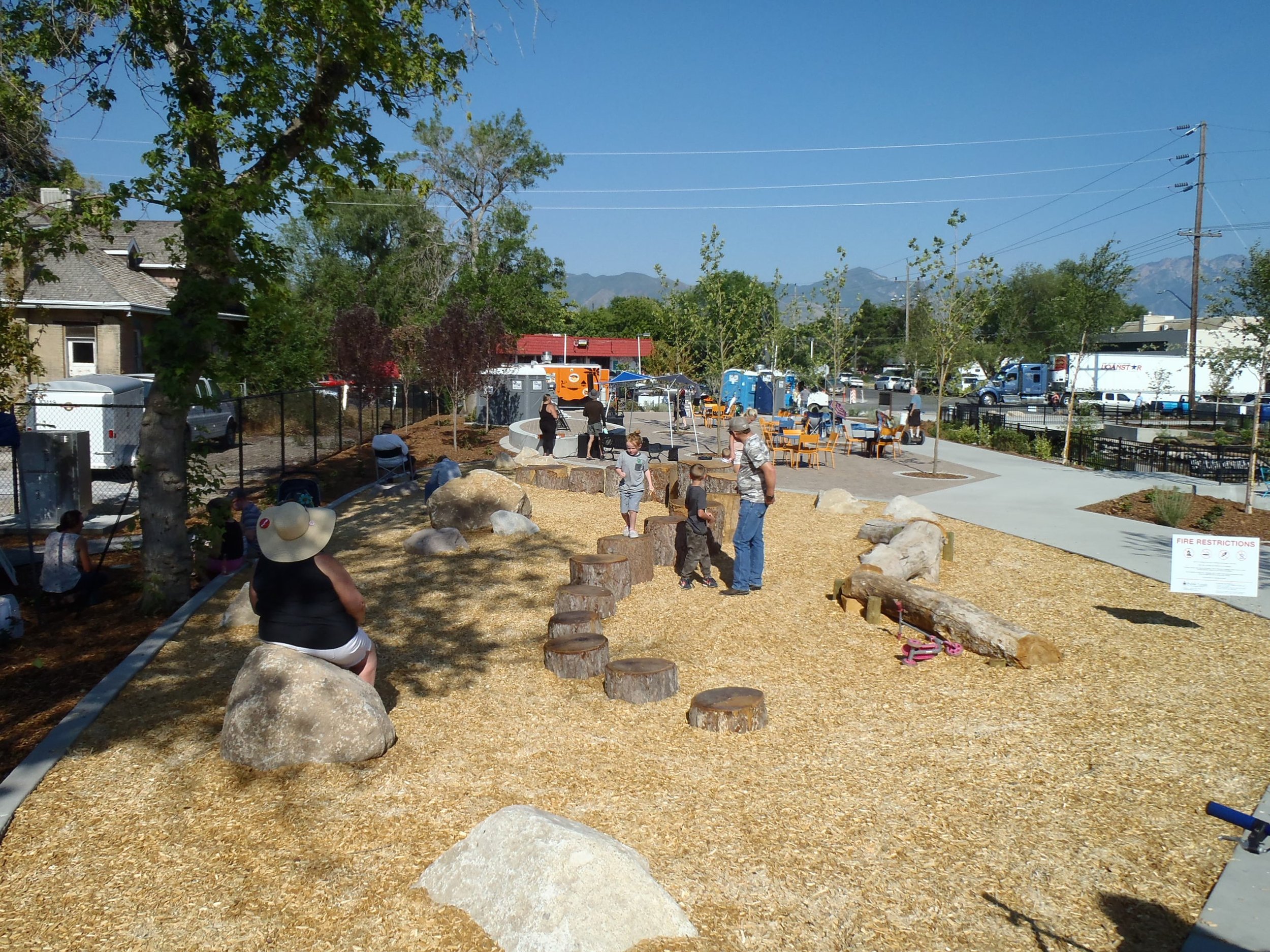
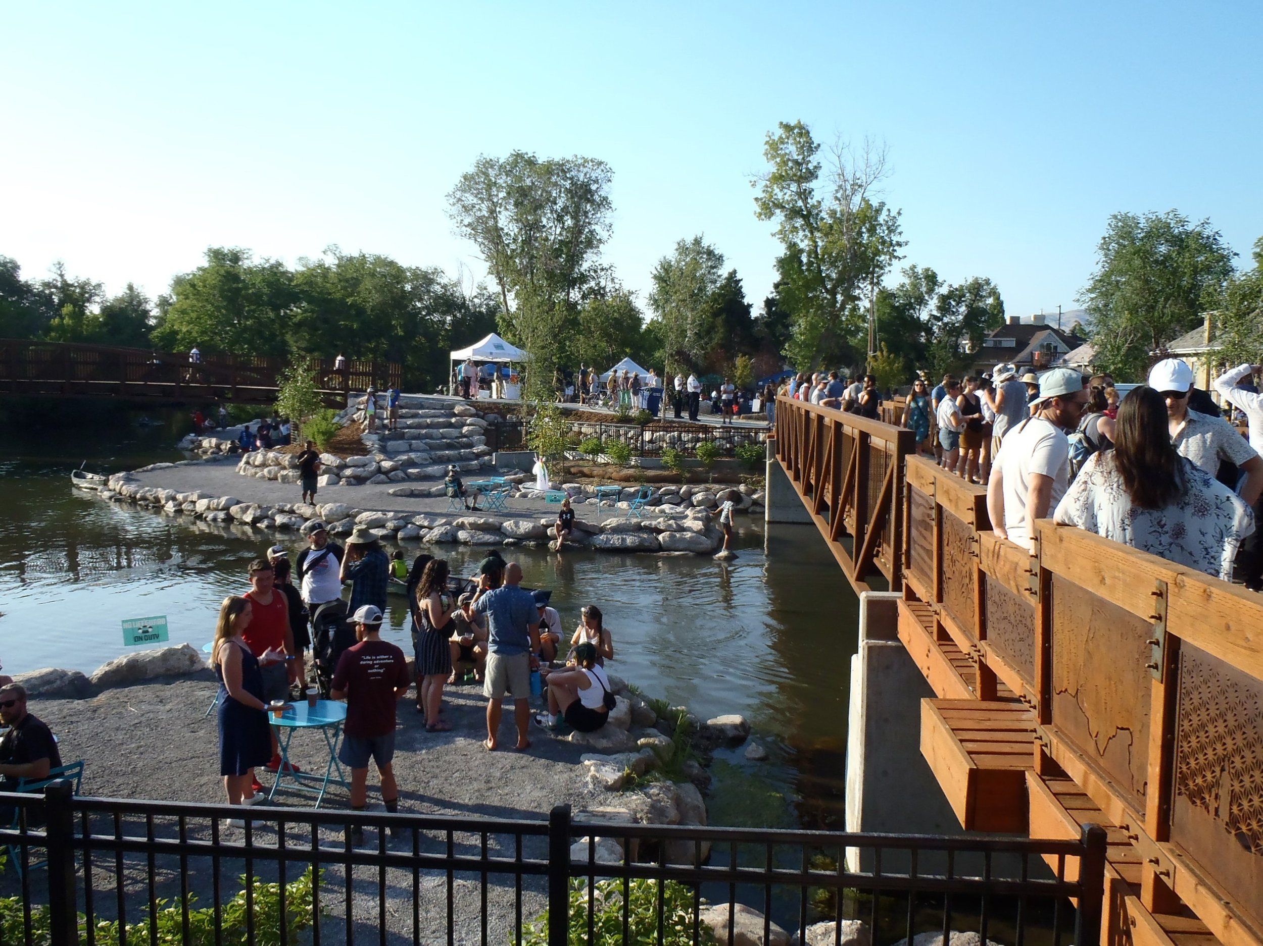
Located on the Jordan River in Salt Lake City’s Glendale Neighborhood, the Three Creeks Confluence Open Space is the first step in the 100-year plan to daylight the City’s urban waterways. This unique community gathering space was created by daylighting 200 feet of the three creeks concrete conduit, which contains the combined flows of Red Butte, Emigration, and Parleys Creeks, where it joins the Jordan River. This project showcases the environmental and aesthetic benefits of uncovering and restoring these local waterways, while also making investments in social equity, economic viability, green infrastructure, and place making in this diverse and often overlooked neighborhood. The new open space is a community gathering place that provides opportunities to fish from the two pedestrian bridges and three overlooks, kayak or canoe on the river or daylighted stream, observe local artist installations, sit and relax in the shade, watch for urban wildlife, climb and play, or participate in local festivities and events at the plaza and stage area.
PROJECT NARRATIVE
The 2.5-acre Three Creeks Confluence Open Space project site previously existed in a neglected condition as an asphalt paved, dead-end segment of 1300 South Street and an abandoned home that had suffered from vandalism and fire. The Three Creeks (Red Butte, Emigration, and Parleys) enter individual concrete pipes that converge into a large concrete box culvert approximately 2 miles east of this location where they eventually empty into the Jordan River at the project site. The project seeks to restore, highlight, and reactivate a unique location along this often ignored and overlooked urban waterway. Project goals included the promotion of health through improved and expanded green infrastructure design, the facilitation of non-motorized transportation by connecting existing multimodal transportation infrastructure, the enhancement of the environment through restored habitat types and improved water quality, and development of community through the creation of a safe place for residents of the neighborhood to connect to the river, environment, and social history in a distressed neighborhood.
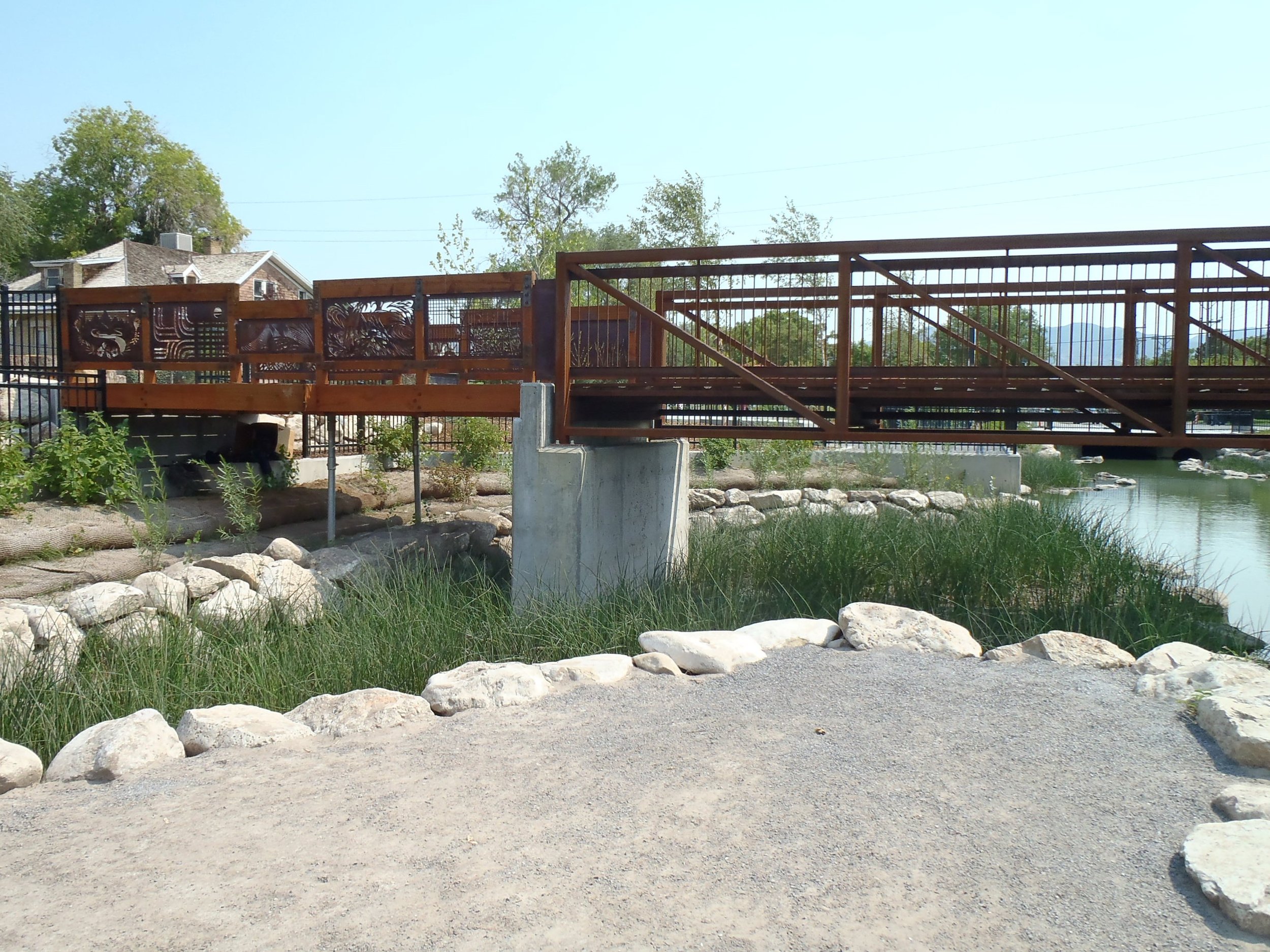
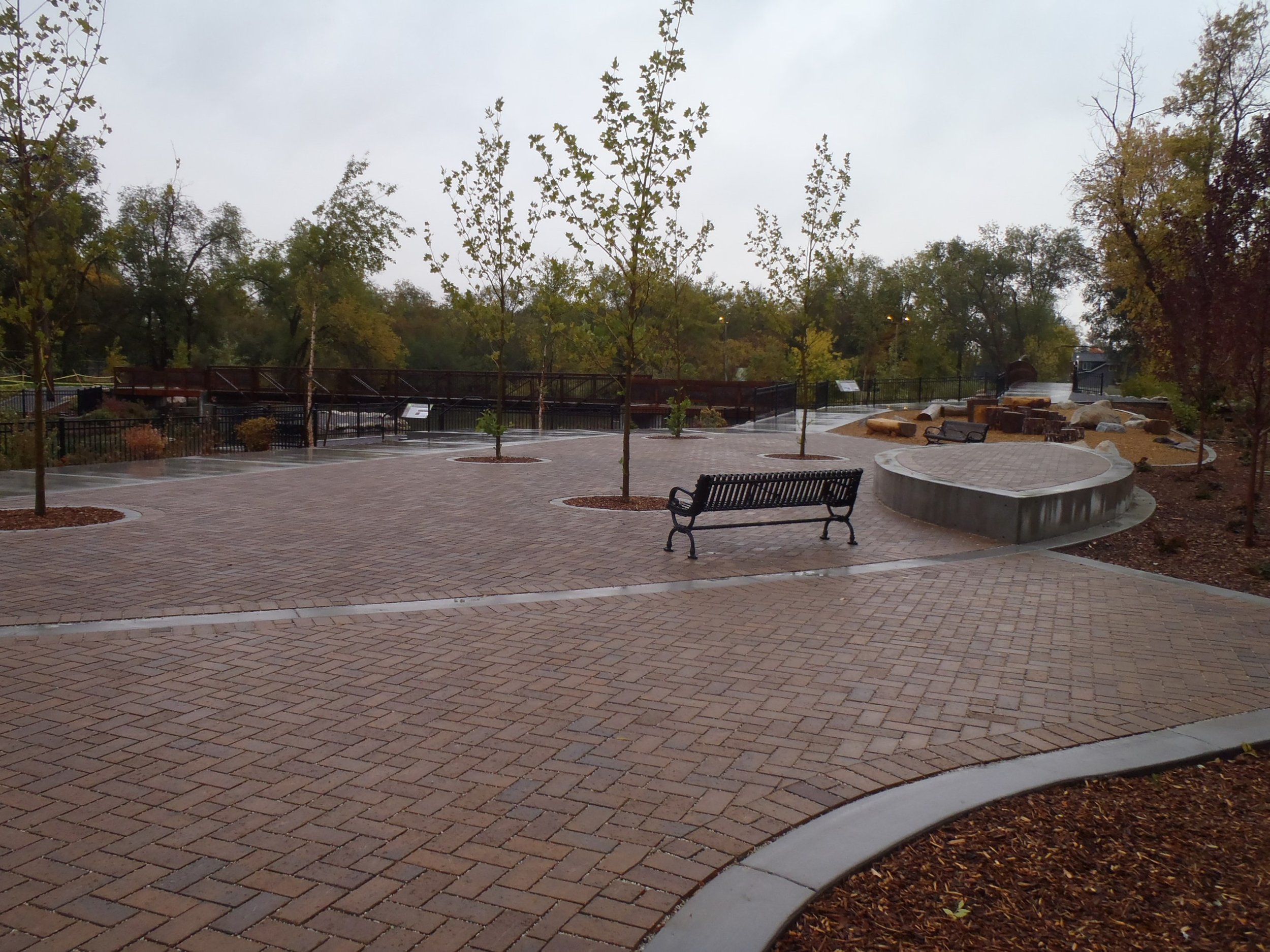
The Seven Canyons Trust and Salt Lake City envisioned the potential of this location as an anchor for future daylighting of the City’s four urban streams as part of a 100-year long master planning effort. Over $3 million was secured from a variety of sources for construction of the project including property acquisition. Where once was urban blight, now exists 200 feet of newly restored open water and adjacent riparian-wetland habitat types. A 120-foot long bow-string style weathering steel bridge connects the site on the east side of the river to the Jordan River Parkway Trail on the west side, while a 100-foot long weathering steel fishing bridge provides an important north-south connection for a future river-side trail on the east side of the river. The project also features porous crusher fines trails, a canoe and kayak rest area for boaters, over 300 feet of shoreline fishing terraces for anglers, a shady picnic area for visitors, an interactive nature play area for kids, a plaza and event space featuring food truck parking and infrastructure, three project site overlooks with interpretive signage, created wetland floodplain shelfs, resilient bio-engineered riparian shorelines, and a pedestrian crosswalk on 900 West Street that now connects major east-west and north-south urban trail systems.
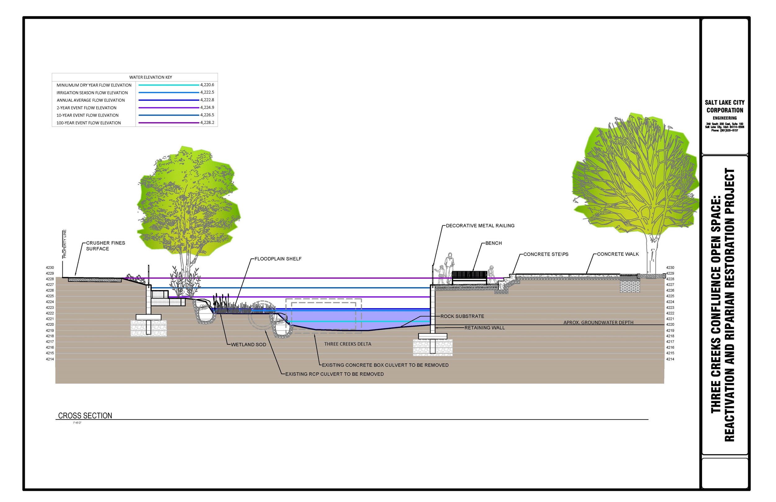
The project design team conducted site and environmental analyses, conceptual planning, detailed design, public engagement, environmental permitting, construction documentation, and construction administration services under contract with the City over a 7-year period. A major design component of the project involved the development and implementation of a detailed two-dimensional hydraulic model for the site which helped define the anticipated depths of water at different flood stages from snow-melt runoff and storm events. As part of a highly urbanized waterway and watershed, the site is subject to large fluctuations in water flow, requiring resilient design features that are subject to high velocity flows and that can be inundated periodically. Wetland floodplain shelfs were designed at the average annual run-off and low-water elevations so that they would remain wet throughout the year, while bio-engineered riparian habitats were designed to withstand flows at the 10-year, 25-year, 50-year, and 100-year flood event elevations. These naturally functioning habitat types are backed up by mostly unseen 9 to 12 foot tall concrete walls that are buried beneath the ground to prevent damage to infrastructure and adjacent properties from potential catastrophic storm events.